Acknowledgement
I would like to show my respect and acknowledge the traditional custodians of this land, the Whadjuk people, and of elders past and present, on which this meeting takes place.
Who am I?
Not an existential question...
Edd Lewis
BGS Standards Lead (& FOSS advocate)
10 years in MinEx/Mining (>5 in Australia)
2 years in Government (Data StandardsCapacity Building/Mineral Promotion/Resource Policy)
edlew@bgs.ac.uk Follow @TwitterDevFollow @koalageoBGS
- National geological survey founded in 1835
- UK custodian of geoscientific information
- Independent
- 600 staff
- Part of UKRI, a not-for-profit public sector research establishment
- Funded by Government & external income
- Offices at Keyworth, Wallingford, Edinburgh & Cardiff
Some BGS Projects
Geovisionary
BGS•Σigma
Groundog Desktop
Text Mining
UKGEOS
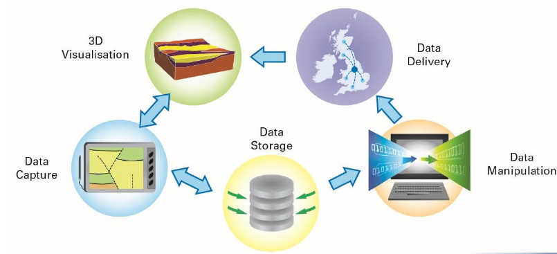
Standards & Bits
Generic Digital Workflow
GeoVisionary > SIGMA > GroundHog
Central Data Store
GeoVisionary
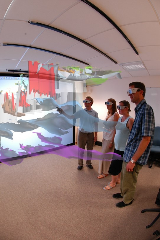
First immersive 3D Visualisation Facility
February 2005
Virtalis Stereoworks
Christie projector: 1400 x1050 pixels @ 100Hz, 4000 lumens
Main use: display of 3D models from Digital Geoscience Spatial Model Programme
GeoVisionary
GeoVisionary
Originated in BGS – Virtalis R&D collaboration
October 2006: VFR – virtual field reconnaissance – improve results and efficiency of fieldwork using VR technology
Solved the problem of utilising BIG datasets – terabytes of terrain and imagery
Data Integration
Real value realised when data are integrated and interpreted as one
Combine any resolution of elevation data with:
imagery, 3D geological models, GIS layers, CAD models, etc
seamless movement through the datasets
Supports time
Virtual geological toolkit enables geoscientists to analyse and interpret data
GeoVisionary
Headsets
Useful low cost visualisation
Immersive
Not so good for working together…
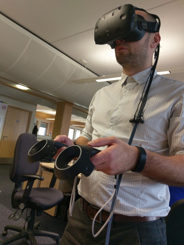
Headsets
Great working environment to understand, interpret and communicate complex 3D information – a common visual language
Greatly increased fieldwork efficiency – make better, faster decisions
Impressive for presentations
Further Info
Bruce Napier (Product Manager): brn@bgs.ac.ukhttps://www.bgs.ac.uk/research/environmentalModelling/3dVisualisation.html
https://www.virtalis.com/products/geovisionary/
Training/Customisation/Development
BGS•Σigma
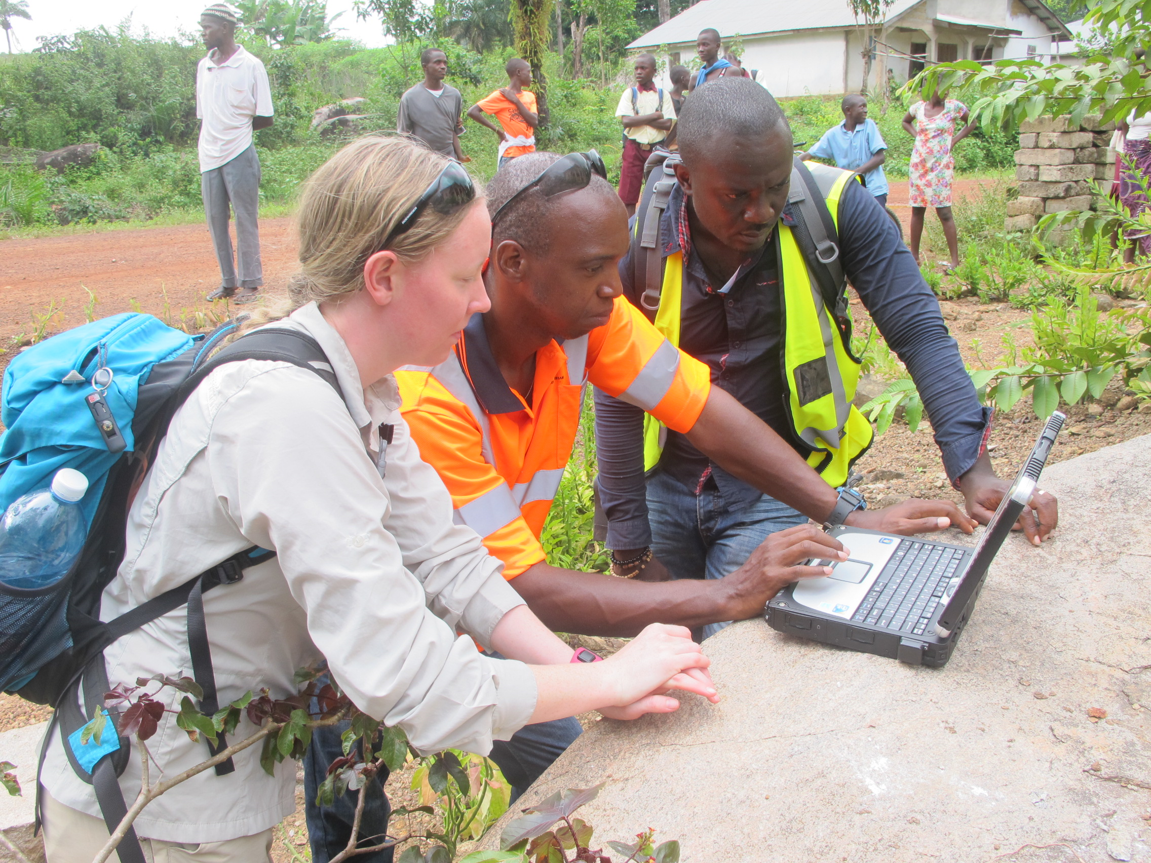
Integrated tool kit for digital geological data capture
Price: Free!
BGS•Σigma
Wanted a new approach with consistant data: field, maps, 3D models, other data products
Prototyped 2001
First release 2006
Latest release 2015
BGS•Σigma
BGS•Σigma
SIGMAdesktop

SIGMAdesktop
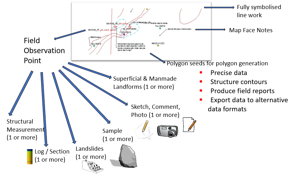
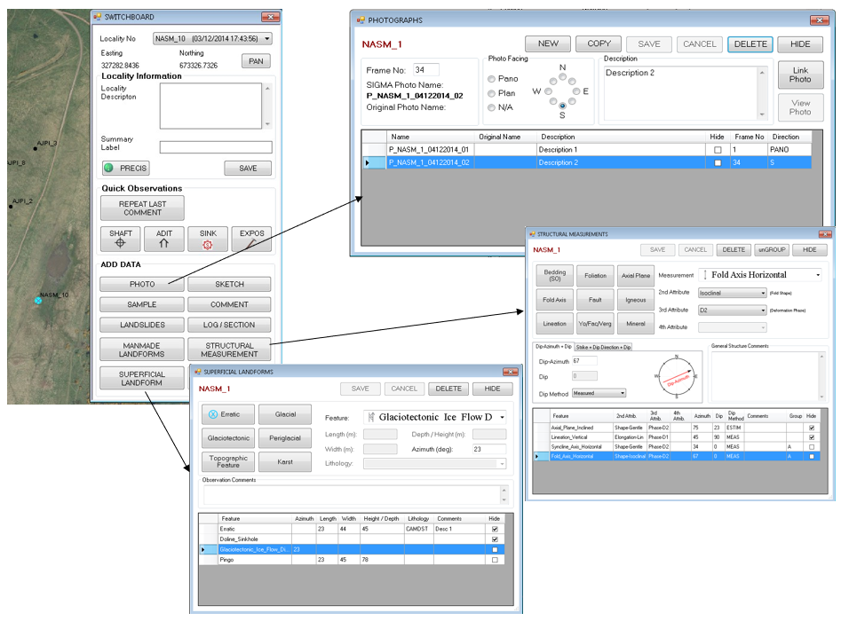
Suite of tools to assist in map compilation and decision making
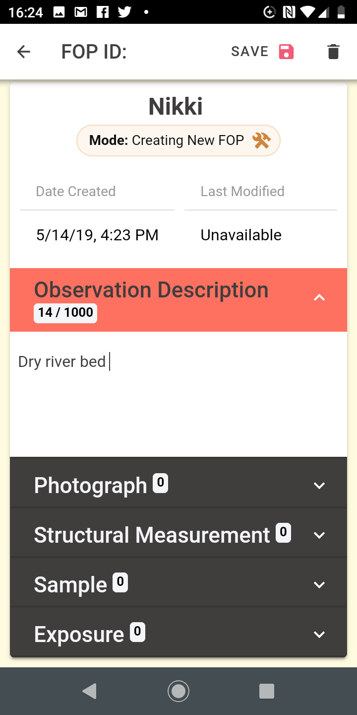
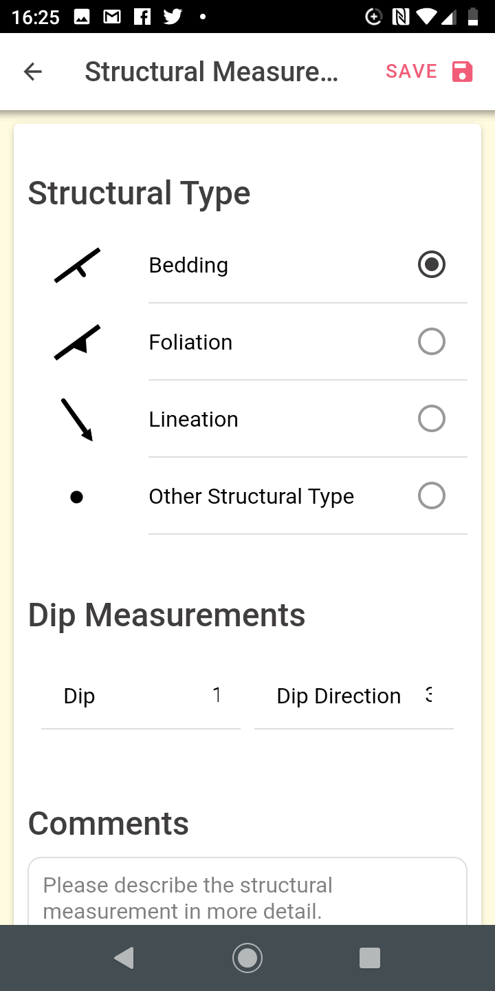
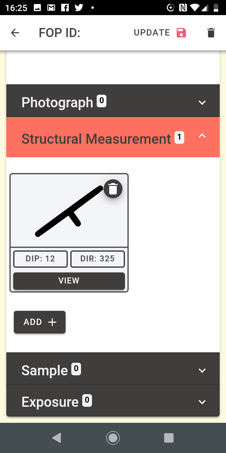
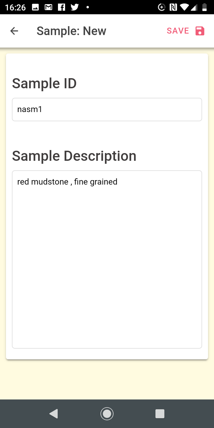
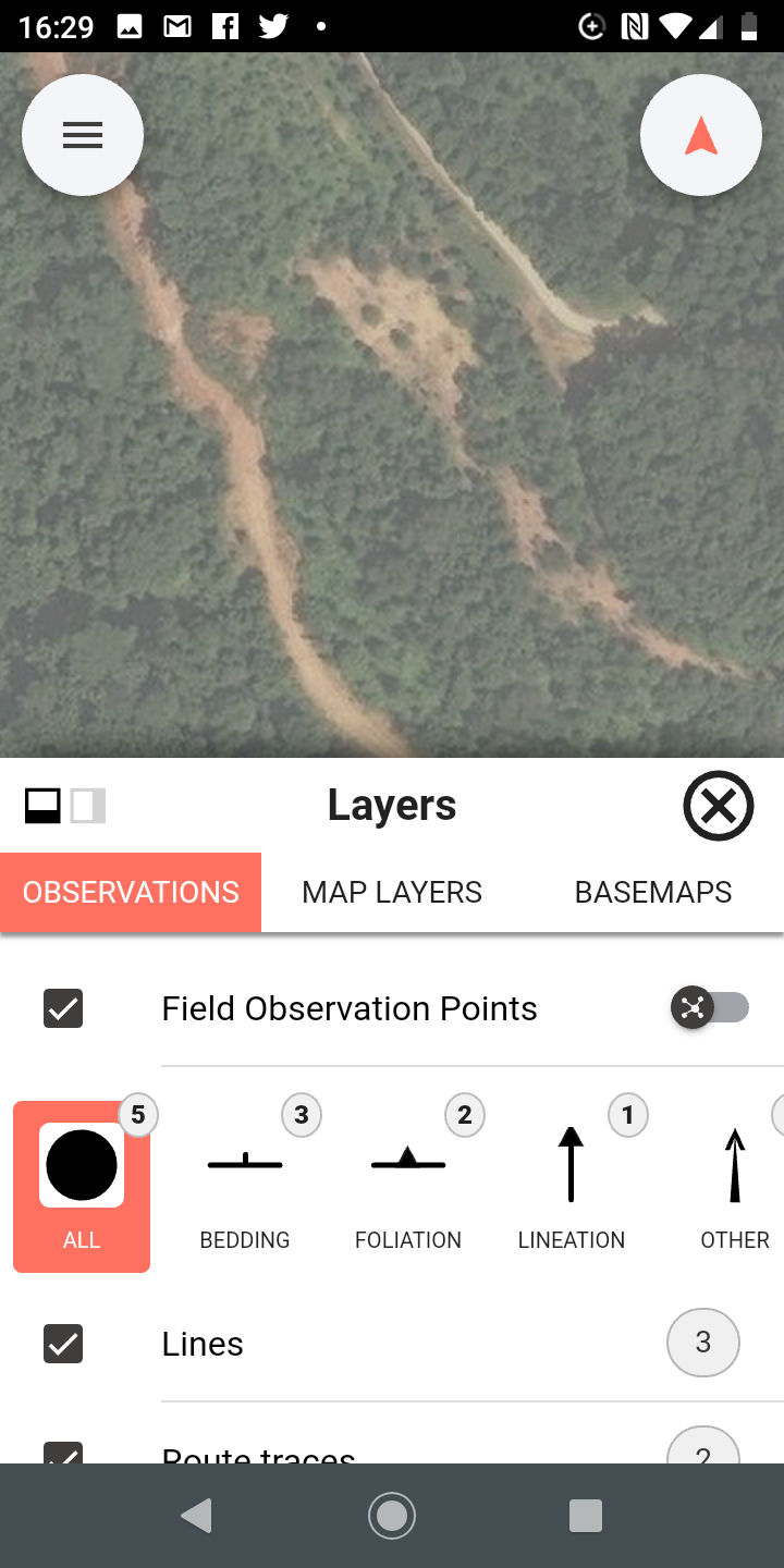
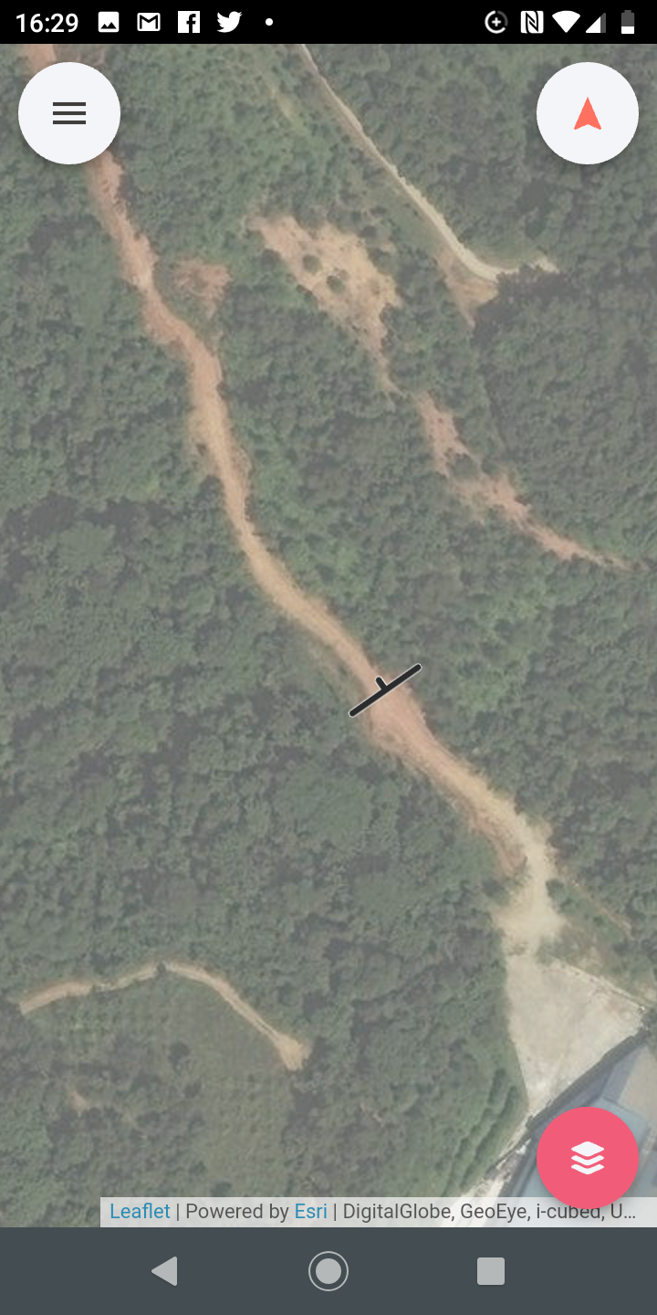
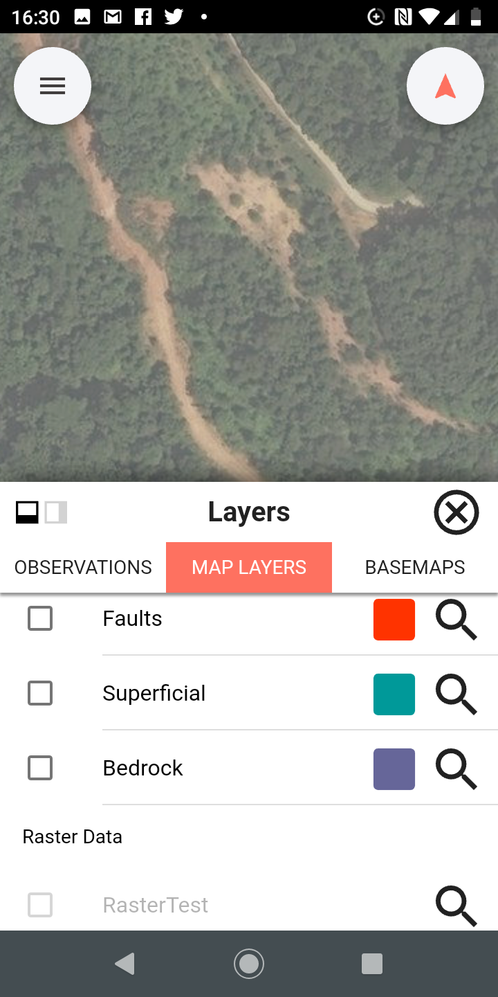
- Combining data from all geologists into one database for generating final data compilation for the project. Entry of field observation points along with linked data
- Cleaning linework
- Generating polygons
- Add more data / hide data
BGS•SIGMate
Coming Soon!
A taster
A taster
A taster
A taster
A taster
A taster
A taster
A taster
A taster
A taster
A taster
A taster
A taster
A taster
A taster
A taster
A taster
A taster
A taster
A taster
A taster
Further Info
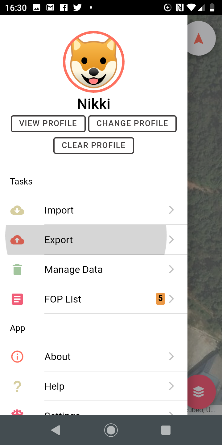
Nikki Smith (BD Digital): nasm@bgs.ac.uk https://www.bgs.ac.uk/research/sigma/home.htmlTraining/Customisation/Development
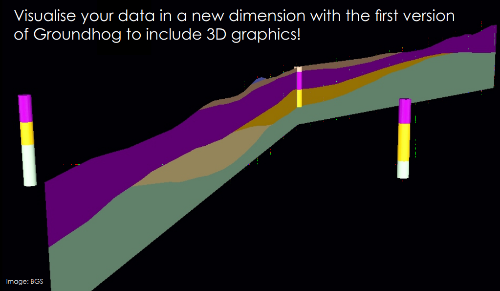
Groundhog Desktop
GroundHog
Borehole Database Integration
Direct link to BGS & OS Web Services
Collab: BGS, GTK, SGU
Latest release 2020!
Community & Professional Editions
Price: Free! (Community edition)
Boreholes
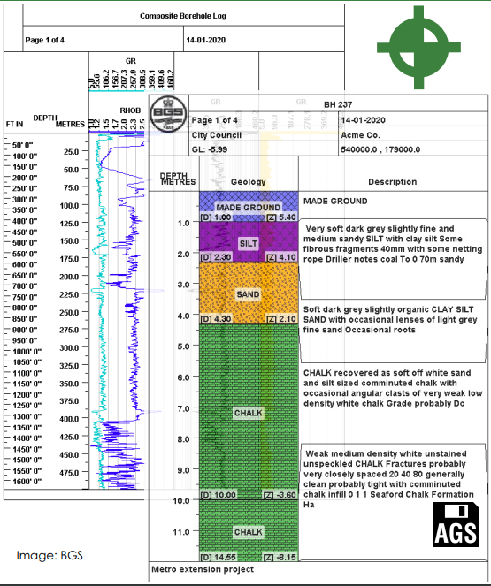
Cross Sections
Implicit 3D Modelling
Only interpolation engine geared to shallow quaternary deposits
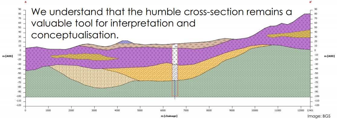
Drawing a Cross-Section
Groundhog Documentation
Moved away from PDF to HTML. Hosted and built on Github Pages using Sphinx
Further Info
LinkedIn / YouTube / BGS Website Ben Wood (Product Manager): groundhog@bgs.ac.ukTraining/Customisation/Development
Knowledge Extraction
Team: Rachel Heaven, Simon Burden, Bob McIntosh, Ike Nkisi-Orji, Marcus Sen, Jo Walsh
Goal
Extract stratigraphic entities and observation locations from unstructured text
Intended benefits:
Interpreted map and model products can contain links to observed data points and conceptual ideas, presenting model uncertainty and provenance
Stratigraphy of an area of interest can be quickly understood from pre-existing literature, saving experts’ time
Explicit and implicit stratigraphic relations can be captured into reusable data for modelling constraints
1. XML Semantic Markup Experiments (early 2000's)
Permian and Triassic
rocks; the Permian strata include
Upper Permian
Zechstein sedimentary rocks that locally
crop out in the study area.2. Converted to training data
							highly 0
							irregular 0
							middle 0
							zone 0
							is 0
							underlain 0
							by 0
							Permian CHRONOSTRAT
							Triassic 0
							rocks 0
							the 0
							Permian CHRONOSTRAT
							strata 0
							include
							Upper Permian CHRONOSTRAT
							Zechstein LEXICON
							sedimentary 0
3. Train a custom Named Entity Recognition (NER) model for strategraphic terms
BGS GitHub Repo
java -cp 4. Run text mining using custom NER model for stratigraphy and core NER locations

5. Stratigraphy entities matched to BGS Linked Data Vocabs
6. Locations resolved to geometry using gazetteer

7. Database of mined data with API

8. Marked up text linked to map
Link if background doesn't load - http://194.66.252.183:81/TextMiningDemo/B01839/9. API supports frequency and corrolation analysis

Loop Project

Involved in WP1 & WP2 knowledge extraction work
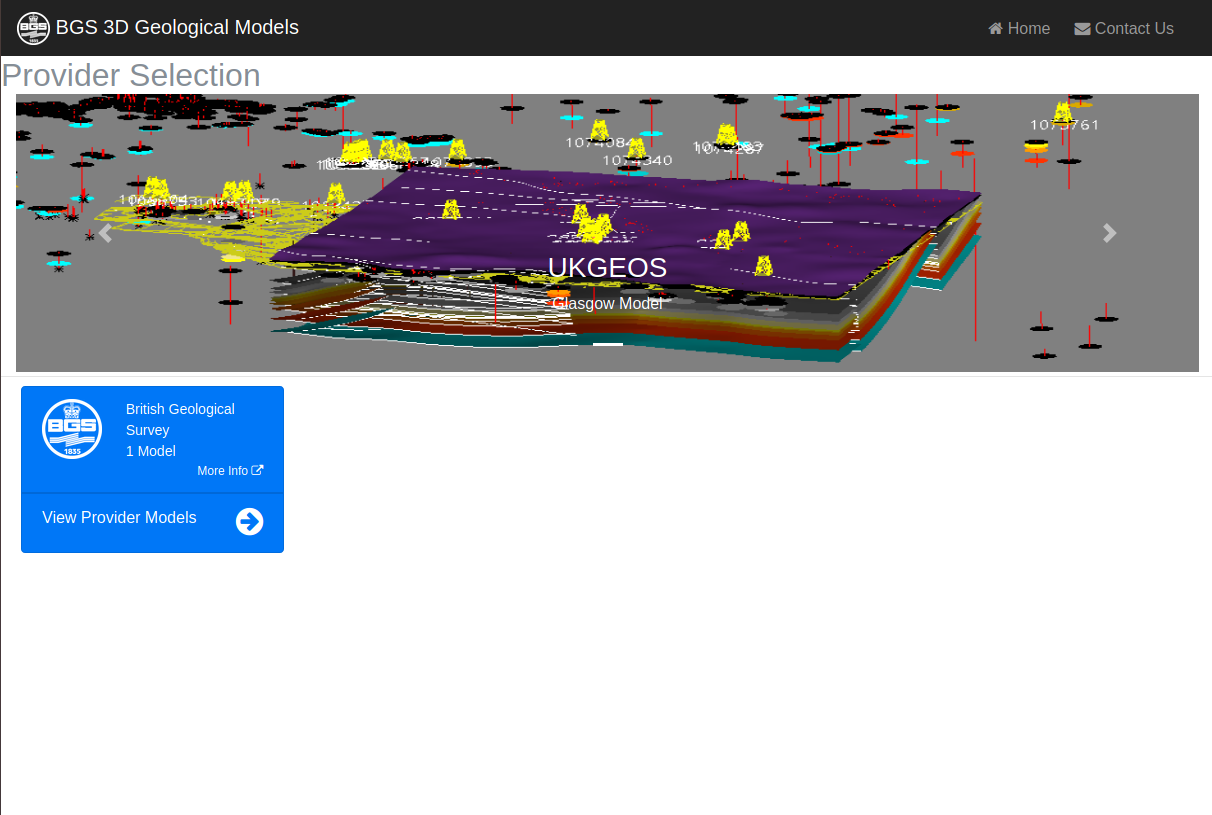
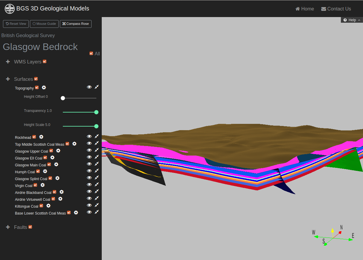
UKGEOS
A a network of observatories is being established to deliver essential new data from deep underground.
UK Geoenergy Observatories
Research Opportunities
Digital Science Lab
Standards
Value of geospatial is becoming more significant as the public and private sectors further embrace location
Standards play an important role in facilitating interoperability of location information and applications for improved situational awareness, business intelligence and decision making.
Standards Timeline
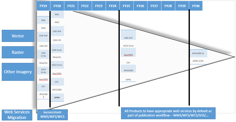
GIS Data
Recently included GeoPackage in data download options.
Starting to also receive GeoPackage with data requests
http://switchfromshapefile.org/Tools
Major issue of symbology tied to ESRI infrastructure
SLYR to the rescue!
SLYR
ESRI to QGIS Compatibility Suite
BGS Data
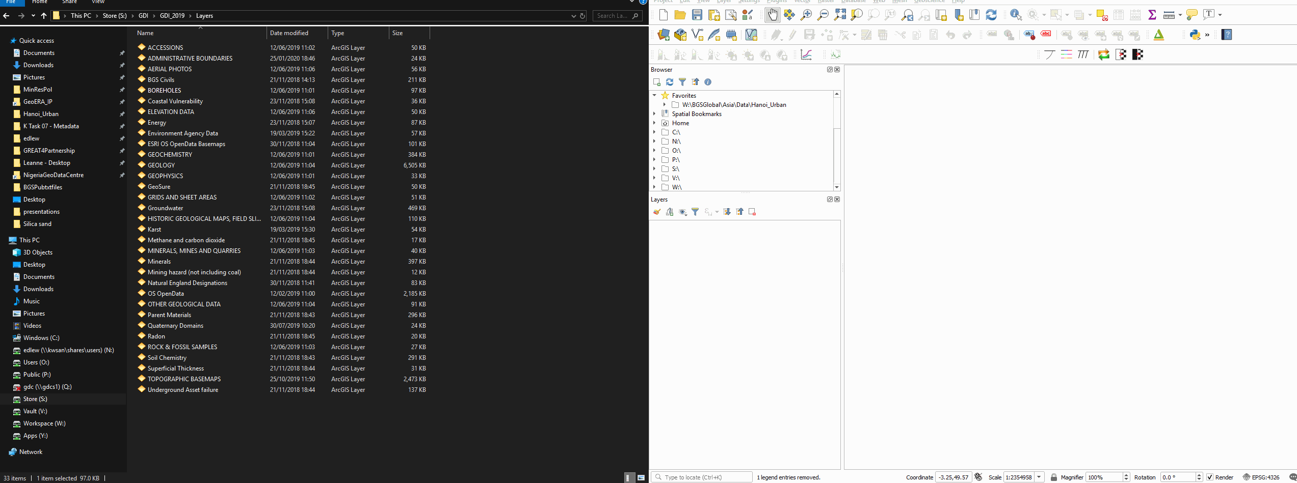
Errors due to CRS (OSGB36) but styling is correct
Reports/Publications
Moving to Digital First - HTML
PDF publications have left us with significant legacy issues.
HTML UK Gov publishing standard
HTML vs PDFPortals
Reviewing TerriaJS
Metadata
Updated to latest version of GeoNetwork
3D Data
Want to move away from 3DPDF
Looking to publish in glTF
Reviewing OGC 3D Tiles
BGS Version
Only took 6 days!
API's
Building API's based on OpenAPI spec
Facilitate better buiding of tools /services
Improving access to data
Will implementate OGCAPI's once set
API's

Wrap Up
BGS always interested in collaboration
In both Research & Technology